فروش ویژه
دانلود ویژه

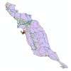
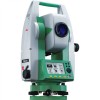
مقاله آموزشی استفاده از gps برای نظارت بر سطح سد را در این قسمت می توانید مشاهده و بخوانید
این فایل آموزشی به زبان انگلیسی و در 14 صفحه می باشد. قسمت چکیده آن در زیر امده است:
Abstract
Dam monitoring relies on the long-term measurement of small structural motions at regular intervals. Traditional surveying techniques and geotechnical instrumentation can effectively monitor one- or two- dimensional modes of motion. However, spatial distribution of geotechnical instrumentation is usually limited to the locations that the instruments can be installed during dam construction, whilst surface monitoring by traditional surveying techniques is a relatively slow process which restricts the number of points that can be regularly monitored. As a supplement to existing geotechnical instrumentation, the Global Positioning System (GPS) offers a reliable and efficient method for three-dimensional monitoring. To date, GPS technology has been successfully applied to a variety of deformation monitoring applications. This paper reviews current GPS technology in the context of its application to dam deformation monitoring. The advantages and disadvantages of using GPS for this type of activity are discussed through three case studies of dam monitoring.
1 Introduction
All large engineering structures are susceptible to movements which may or may not be within design specifications. As the consequences of failure are severe, monitoring of dams commences in the early stages of construction, when it is important to validate assumptions made at the design stage, particularly regarding foundation seepage control. At the completion of the structure, monitoring is applied to control dam stability and behaviour, and continues at the stage of the dam’s first impounding so that the safe establishment of the structure can be closely observed.
Thereon, long-term monitoring of operational behaviour and regular measurement of stress states is maintained, to ensure that each component of the structure is functioning as intended.
The structural and geotechnical information needed to assess dam stability is primarily obtained with instrumentation systems that may vary for different monitoring purposes. The desirablecharacteristics of these systems include proven durability and robustness, simplicity of maintainance and use, provision of regular and reliable data sets, and minimal personnel requirements for the collection of data.
Although many different types of dam exist, the majority of instrumentation systems installed on dam structures are aimed at monitoring the following key precursors to failure: ground water pressure; chemical properties of the soil; pressure and stresses within the ground or structure itself; surface displacements on the dam structure or the surrounding bedrock. With respect to deformation properties, no two dams are identical and thus performance conclusions of one dam cannot be extrapolated to that of another. For this reason, each dam must be monitored regularly with a number of instruments (Wilson 1973). A typical dam will contain piezometers of various types, total stress cells, settlement devices, triaxial deformation tubes, inclinometers and extensiometers, all installed below the surface at the time of construction. Full details regarding geotechnical instrumentation and their arrangements can be found, for example, in Dunnicliff (1993), Fialovszky (1991), Bolt and Hudson (1975). Each of these instruments will be read regularly at intervals typically from one week to three months depending upon their relative importance and the era in the dam’s life (Martin et al 1990). More recent systems can deliver .......
دوستان عزیز، لطفا قبل از دانلود محصول، اطلاعات مربوط به محصول که در زیر آمده است به دقت مطالعه فرمائید:
۱) فایل ها و تصاویر موجود در سایت تنها با نرم افزارهای مرتبط قابلیت مشاهده دارد و باید این نرم افزراها بر روی سیستم شما نصب شده باشد.
۲)لایه های نرم افزاری مختلف، قابلیت همپوشانی دارند و می توانید با دریافت دیگر فایلها از آنها استفاده نمایید.
۳) پیش از استفاده از نرم افزار مرتبط، لازم است فایل دانلود شده را از حالت فشرده خارج نمایید. جهت این کار لازم است از فایل های وین رر و زیپ استفاده نمایید.
۴) چنانچه موفق به دریافت و تهیه مستقیم فایل نشدید، با ما در تماس باشید تا در اسرع وقت به درخواست شما رسیدگی شود.
5) جهت استفاده از خدمات سایت پیشنهاد می شود که عضو سایت شده و مطالب ما را از طریق خبرنامه نیز دریافت نمایید
6) تخیف های دوره ای و هفتگی سایت را می توانید از طریق کانال تلگرامی پی دی اف یار پیگیر شوید و از آنها در زمان مقرر استفاده نمایید
7) توجه داشته باشید، که درج قیمت برای محصولات فایل مجازی فروشگاه به منزله قیمت واقعی محصول نبوده و تمام تلاش شده است تا محصولات به صورت رایگان و با حفظ حقوق مولف در فروشگاه بارگذاری شود. با این وجود هزینه های جانبی نظیر هزینه های نگهداری سایت موجب شده است تا حداقل هزینه برای آنها در نظر گرفته شود. لذا بیشتر هزینه پرداختی توسط کاربران، صرفا جهت حمایت از سایت می باشد.
از اینکه سایت پی دی اف یار را به عنوان مرجع تهیه اقلام مورد نیاز خود انتخاب نموده اید، سپاسگزاریم
| فرمت فایل | |
|---|---|
| پی دی اف (PDF) | |